


Map Overlay Instructions
Unit 2—Lesson 5: Part 3E
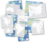
The 13 colonies that fought in the Revolutionary War became the first 13 United States. Today you will attach clear overlay pages to your PlaceMap and trace the boundaries of the original 13 colonies on one of the overlays. To do so you will need two overhead transparency sheets, clear tape (wide packing tape is best) and the USA PlaceMap. Put the PlaceMap with the map side up on a table. Lay one transparency lengthwise alongside the left side. The transparency and PlaceMap should line up exactly from top to bottom. Tape the two together along the seam, hinge style. Put an additional long piece of tape along the seam on the back side as well. Using the other transparency sheet, follow the same instructions for the right side of the PlaceMap. Fold both transparency sheets at the hinge and lay over the map. If you have lined up everything just right, they should meet in the middle. You are now ready to make your first overlay map.
Click here to download the outline map that shows the original 13 states and the Line of Proclamation, then print it. Slip the map under the right transparency and line it up carefully with the top, right, and bottom of the PlaceMap. Trace the boundaries of the 13 colonies on the transparency sheet using a Vis a Vis overhead projector pen or other water-based marker. If you make a mistake you can erase with a damp paper towel or sponge and try again. When you are finished, remove the template. Look at the maps carefully, and compare your new transparency with the United States map pictured on the PlaceMap. Discuss their differences with your teacher. Do you notice anything interesting about the colony of Massachusetts on the new transparency?5 Do you see any other differences?6
Answers:
5. It includes the area that is now the state of Maine.
6. Answers will vary, but might include mention that the colonies of Georgia, North Carolina, Virginia, and Pennsylvania, were smaller than they are now; New York includes the area that is now Vermont, and does not stretch as far north and west as it does now.
Unit 3—Lesson 1: Part 1E
Today you will draw another map on the PlaceMap overlays. First, find the map in your United States History Atlas entitled “Growth of the United States to 1853.” Notice the area that was added by the Treaty of Paris. Now carefully draw the western boundary of that area directly onto the transparency that is folded over the PlaceMap. Use the water based pen you used for the 13 colonies map. The eastern boundary runs mostly along the Line of Proclamation, and the western boundary follows the Mississippi River almost all the way to the top, where it is slightly different. You may cross over a bit on the left transparency sheet if needed. Remember, your boundaries do not have to be perfect—just do your best! When you are finished, color and label the Treaty of Paris on the map overlay.
Compare your new transparency to the one you made in Unit 2, and notice how the size of America changed because of the Treaty of Paris. You can see by looking at the maps that this was a great leap forward in the size of our nation. On this map, you can see the names of the states and their borders shown by dotted lines. These dotted lines show the borders of each state as it is today. In your Student Notebook, make a list of the states that expanded, or grew larger, because of the Treaty of Paris.1
Look at the map in your history atlas again. Now make a list of current states that were established on land that was added to the United States by the Treaty of Paris.2
5th and 6th grade assignment: Look again at the map transparencies you have made. How much of an increase to the size of America did the Treaty of Paris bring about? You can answer this by estimating or by finding an exact amount.3
Answers:
1. New York, Pennsylvania, West Virginia, Virginia, North Carolina, and Georgia.
2. Ohio, Kentucky, Tennessee, Alabama, Mississippi, Illinois, Indiana, Wisconsin and Michigan.
3. The land mass of the United States more than doubled.
Unit 3—Lesson 2: Part 1E
Today you will continue working on the map overlay you began in Lesson 1. To get started, look again at the map in your United States History Atlas entitled “Growth of the United States to 1853,” and find the area that shows the Louisiana Purchase. Now use a wet erase marker to draw the western boundary of that area directly onto the left overlay. You may cross over on the right transparency sheet if needed. Use the state borders to decide where your lines should go and remember, it doesn’t have to be perfect—just do your best! If you make a mistake you can erase with a damp paper towel or sponge and try again. When you are finished, color and label the Louisiana Purchase on the map overlay.
On the PlaceMap, you can see the names of the states and their borders as they are today. Write the current state that expanded, or grew larger, by the Louisiana Purchase on notebook paper.1
Look at the map again, and make a list of current states that were established on land that was added to the United States by the Louisiana Purchase.2 Date and add the new page to your Student Notebook.
5th and 6th grade assignment: Look at the map. How much of an increase in the size of America did the Louisiana Purchase bring about? (Do this by estimating.)3
Answers:
1. Minnesota
2. Iowa, Missouri, Arkansas, Louisiana, Oklahoma, Kansas, Colorado, Nebraska, South Dakota, North Dakota, Montana, and Wyoming
3. It looks like the United States doubled in size due to the Louisiana Purchase.
Unit 3—Lesson 3: Part 1E
In this part you will add to the map overlay you’ve been working on in this unit. To get started, look again at the map in your United States History Atlas entitled “Growth of the United States to 1853,” and find the territory added by the Florida Cession. Notice that the northern border of this territory is exactly the same as the current border of Florida. Trace over this boundary on the transparency, then color and label it.
On the PlaceMap, you can see the names of the states and their borders as they are today. List the current states that expanded, or grew larger, by the Florida Cession on notebook paper.1
Look at the map in your history atlas again. Now name the current state that was established on land that was added to the United States by the Florida Cession.2 Date and add the new page to your Student Notebook.
Answers:
1. Louisiana, Mississippi, and Alabama
2. Florida
Unit 3—Lesson 4: Part 1E
Today you will finish the map overlay you’ve been working on in this unit. To get started, look again at the map in your United States History Atlas entitled “Growth of the United States to 1853,” and notice the territories added by the above actions. Use a wet erase marker to draw the boundaries of these areas directly onto the transparency. Remember to pay attention to the state borders when you decide where your lines should go. Now, trace the Texas Annexation in the middle and the others on the left transparency. Color and label the new territories on the map overlay.
Several types of nation building appear in this lesson: cession, treaties and annexation. More than one element of nation building was seen in the Mexican Cession, since land was ceded, a treaty was signed, and money was paid for the lands received. Often expansion had more than one element of nation building as part of the process to gain new lands.
Use your PlaceMap to fill in this chart with the states, or parts of states, added to the U.S. by each event.1
Answer:
1. Texas Annexation (1845) - Texas, New Mexico, Oklahoma, Kansas and Colorado Oregon Country (1846) - Washington, Oregon, Idaho, Montana, Wyoming Mexican Cession (1848) - California, Nevada, Arizona, Utah, Colorado, Wyoming, New Mexico.