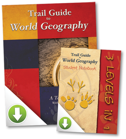


Trail Guide to World Geography
by Cindy Wiggers
Share:


Trail Guide to World Geography is a family-friendly, multi-level curriculum guide for students in grades 3-12 to learn geography. With its trail markers (animal track icon) directed at three different grade levels, this book can be used for more than one academic school year and works well with a number of different student abilities learning together.
There is not one exact way to use this unique course. It was designed with flexibility in mind to better meet various objectives when teaching geography. Trail Guide to World Geography provides activities and assignments for a 36-week school year on World Geography.
Students spend 5-10 minutes a day with the atlas drills to establish and maintain atlas usage and map reading skills. Some folks use the book strictly for the Geography Trails section alone and say it’s worth every penny at that!
Add an outline map with the Mapping list of places to label and students have a smooth beginning to creating a great World Geography Notebook. Additional assignment choices take students deeper to learn about key places around the world. You set your pace and objectives. Spend as much time as your schedule allows. You can always use the book again another year, with all new atlas drills questions.
There are three sections of assignments for each week. You can use all three sections or any combination.
Geography Trails Weekly: Days 1-4
In the weekly Geography Trails section you will find daily short atlas drills at three different levels. Students follow their assigned trail and, using the required atlas, answer two questions a day. They gain practical experience with map reading and atlas usage in a light-hearted and natural way. Many especially enjoy the challenge of finding the answers in this 5-10 minute activity.
Mapping Weekly
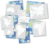
Weekly mapping lists provide opportunities for students to label an outline map for inclusion in their personal Geography Notebook. Most students will complete the mapping assignment in one sitting. (Outline maps are not included.)
Trail Blazing - Personal Research and Discovery
The Trail Blazing section fleshes out the remainder of the school week. Here you will find a number of various type of assignments to choose from. So, in addition to the five-minute atlas drills and the mapping activity students (or teachers) select two to four of these Trail Blazing assignments each week to complete. Assignments span all learning styles and cover many topics of interest.
Students will use outside resources, such as library or Internet for most of the Trail Blazing assignments. Some example of the kinds of assignments include: creating a chart or graph, research and study, art or craft, meal planning and preparation, designing a travel brochure, making flash cards or a crossword puzzle to aid in memorization, creating an illustrated geography dictionary, and so much more.
Literature Unit Component
The final weeks of the school year we change it up with a Literature Review Unit. Using family read-aloud time and Around the World in 80 Days by Jules Verne, students map the trail of Phileas Fogg and Passepartout, and complete other activities. Some families do this nine-week unit during the summer months as an introduction to the upcoming world geography studies.
Using the Trail Guide to World Geography as your core, students will:
- Gain experience with map reading using an atlas
- Create their own personal geography notebook, or portfolio
- Develop critical thinking skills
- Study cultures and peoples
- Learn countries and capitals
- Much more
Resources used with Trail Guide to World Geography
Trail Guide to World Geography is not a stand-alone textbook. Frankly, that’s what makes it interesting for students. So it’s important that you provide the level appropriate atlas and some outline maps to complete the course. We’ve made that simple for you by creating a discounted set of materials we call GeoPacks. You might also want to add any of the other recommended resources to have handy as regular resources for many of the Trail Blazing assignments. Most can be used again when students have moved up a level:
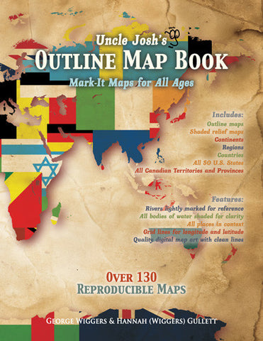
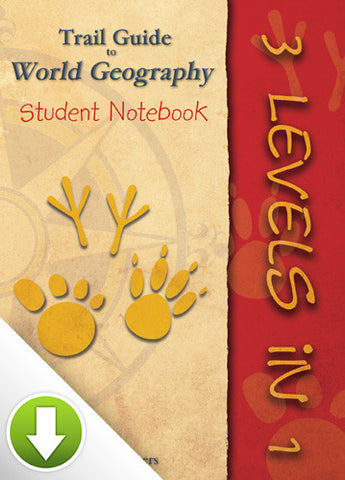
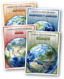
- 3-Level Trail Guide to World Geography Student Notebook printable pdf files (or a good set of outline maps) form the core of the geography notebook. Of course, we recommend the Uncle Josh’s Maps book or collection on CD-ROM if you don’t choose to use the Student Notebook files.
- World Atlas — required resource for atlas drills and mapping assignments. The specific atlases below were used to form the questions making it a basic 5-minute drill. You know the answers are there. A separate atlas is needed for each level.
- Elementary level (3rd-4th grades) — Junior Classroom Atlas
- Middle School Level (5th-8th grades) — Classroom Atlas
- High School Level (high school) — Atlas of World Geography
- Around the World in 80 Days — read-aloud novel for the 9-week literature review unit
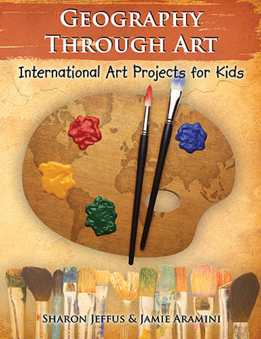
- Geography Through Art — You can cover art while teaching geography if you select any of the Geography Through Art projects listed in many of the weekly Trail Blazing section. This book introduces world cultures in a medium children enjoy and relate to - Art! They learn what children in countries around the world do for art and create their own from the instructions provided. Many projects come with fascinating information of historical significance. Step by step drawing examples help students draw a number of different animals and more, and all project include great simple to follow instructions.
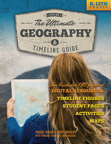
- The Ultimate Geography and Timeline Guide — For added depth at the middle school level, course credit at the high school level, and basic geography instruction for parents who have little to no understanding of geography. Covering kindergarten through high school this book can be used every year. Includes CD-ROM with over 150 printable pages and lots of fun activities and ideas for incorporating geography while learning other subjects. It is referred to by page number throughout Trail Guide to World Geography when it can be used as a Trail Blazing resource.
Save money with GeoPacks — specially assembled bundles to include everything you need to embark upon an exciting adventure in geography.
Selecting the Level Appropriate for Your Child
Grade levels associated with this curriculum guide are provided as a general guideline. If your student has had little or no introduction or experience with studying geography or with reading an atlas you may want to consider using the lower level in the range given. Also consider reading ability when choosing between Primary and Intermediate levels for a fourth grader. If your student is a solid reader the Intermediate atlas may be more suitable. If using the Intermediate atlas, then also use the Intermediate “trail.” With all levels select Trail Blazing assignments with your student’s abilities and interests in mind.
Elementary, 3rd-4th grades
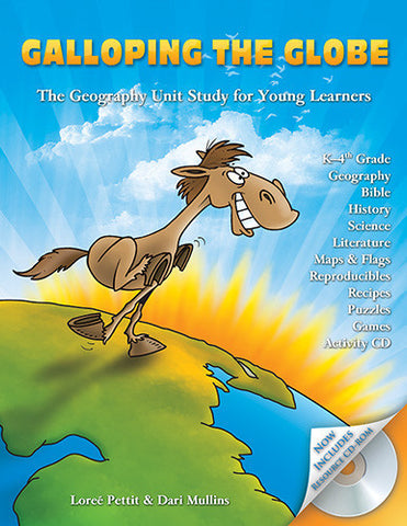
Elementary level is suitable for most third and fourth graders and for second graders who are reading to learn, not still learning to read. Students in grades three and under who are struggling readers may enjoy Galloping the Globe for their world geography studies instead. It uses a different approach, and can be a better choice to use while the student spends more time focusing on developing reading skills. This book is arranged by continent and flows easily with younger students while using Trail Guide to World Geography with the older students who have more solid reading skills. Everyone should study the same continent together, each in a method most suitable to their current learning abilities.
Be flexible with how your student may report what he has learned. You may allow him to give you an oral report if writing is difficult. Or you may want to combine geography with writing by selecting an assignment once a month or so that requires writing a summary.
Middle School, 5th-8th grades
If your student particularly enjoys mapping assignments and going deeper, watch for Intermediate level trail markings in the mapping section. The mapping assignments for that trail marker are found in The Ultimate Geography and Timeline Guide. Students doing these more complex mapping assignments will greatly benefit from using the larger, desk-sized continent maps.
High School, 9th-12th grades
If you wish your student to earn a semester credit for high school, we highly recommend using The Ultimate Geography and Timeline Guide along with Trail Guide to World Geography. Follow the secondary markings for all mapping and any Trail Blazing options. There is a printable guide for high school credit in the "Samples" tab.
Do you have younger students, too?
Teach your younger students world geography with the unit study approach using real books with Galloping the Globe. Follow the schedule of Trail Guide to World Geography and everybody learns geography together at their own levels!
"This book was truly inspirational to me! I LOVE the concept! Here's what the author, Cindy Wiggers, says in her introduction: 'Wouldn't it be exciting to turn your geography studies into a guided trip around the world? How wonderful to just sit back and relax as the guide shows the way and takes your students through a learning experience they will never forget.' WOW - I like that idea! What excited me even more is that this book was specifically written for the whole family! You can use the same book for all your children from second grade up through tenth! THAT is exciting!"
—Holly Cameron at The Old Schoolhouse Magazine
"This versatile product is suitable for use in the individual homeschool as well as a co-op, with questions and activities for a wide range of ages and abilities."
—Jean Hall at Eclectic Homeschool Online
"With this easy-to-use course students will learn to recognize important characteristics and traits of each continent, read and create maps, identify key geographical terms and more."
—Cindy Pretchel at Homeschooling From the Heart
"Trail Guides can be used to teach geography to children in grades 2 through 12. The series of three Guides cover United States, World, or Biblical geography, respectively. Each volume is set up to address students at three different levels. This means that each volume can then be "reused" for up to three years of geography study as students move from level to level. Generally, you would not use the same book two years in a row, but would shift to another book, returning to a book a year or two later. Trail Guides differ greatly from traditional textbooks since they use a discovery-inquiry approach with lots of activities. Students will need an appropriate atlas for much of their research."
—Cathy Duffy Reviews
"Trail Guide to World Geography provides a well-laid out plan to make geography studies interesting and painless."
—HomeschoolChristian.com
“The Trail Guide to World Geography is great...gives us the resources to enjoy learning. Thank you.”
—K. Byrnes
"I thought this was one of the best geography programs I had ever seen. It breaks it down into about 5-10 minutes a day for 4 days a week. It teaches you mapping, how to read everything on an atlas, basically everything you need to know! There are extra activities in every section that just adds to your child's knowledge of different countries, cities, etc. It is very easy and goes quickly so that the child is not bored with it. I loved how easy it was to teach and how easy it was for my son to go through. There were many days he would be up and doing it on his own without my help!! I would recommend this for anyone!"
—Rebekah at Successful Homeschooling
"This is the kind of geography that makes learning fun. I highly recommend it to everyone. My girls enjoyed this study."
—Penny at Successful Homeschooling
“The Trail Guide was my ‘Big Find’ at the home school convention this year. I tell all my friends, ’You gotta’ have this book.’”
—A. Cooper
"We have just loved it! If we skip a day the kids are just all over me! Following the current events just made a tremendous difference in our home school this year."
—VA homeschool parent
"I really appreciate the wonderful customer service. I also wanted to tell you once again how much I love your geography program. I am so grateful to you for having put all this together. My high school age daughter has suffered due to lack of geography in the previous years. I hope to avoid her struggles with geography in my younger children whom I homeschool. I have no doubt that your geography program will lead to success for them."
—A. Guelcher
"Thanks so much for an awesome curriculum. We are in our second week using the book with our co-op. There are fifteen students in grades 7-10. I'm loving the material...probably more than the students at this point because I don't remember ever being taught such interesting material!"
—L. Rider
"We completed Trail Guide to World Geography and thoroughly enjoyed the course! We used it with three children (3rd, 6th, and 11th grades, respectively), so there one student in each track. My high-schooler even earned a half-credit for the course. Thank you!"
—T. Rodman
Reviews
| Publisher: | Geography Matters |
| ISBN: | 9781931397155 |
| Edition: |
2009 |
| Product: | |
| Format: |
Paperback |
| Size: |
8.5" x 11" |
| Pages: |
128 |
empty
What other resources do I need to use the book?
Highly Recommended:
- Outline Maps for mapping assignments (We recommend Uncle Josh's Outline Map Book or CD ROM) or World Map Set (Large paper maps of each continent and the world)
- World Atlas for mapping assignments and daily geography drills
- Primary/Elementary level (2nd-4th grade)—Jr. Classroom Atlas
- Intermediate/Middle School level (5th-7th grade)—Classroom Atlas
- Secondary/High School level (8th grade-high school) —Atlas of World Geography
Additional Helpful Resources:
- Around the World in 80 Days by Jules Verne — used during the last 9 weeks of the year for literature unit. Students will travel the world with the key characters of this classic mapping the trail and choosing from a variety of additional assignments. You may be able to obtain this book from the library.
- Geography Through Art by Sharon Jeffus and Jamie Aramini — used for all art projects. Categorized by continent and listed in the Trail Guide, which project to do when appropriate to where your study has taken you.
- Encyclopedia of World Geography — Key resource for Trail Blazing assignments. Or students can use library, Internet, etc.
-
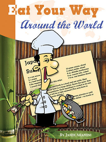
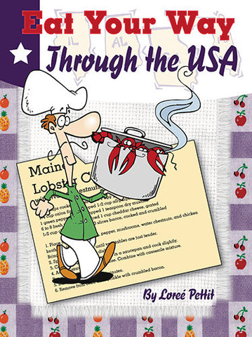
Eat Your Way Around the World — This cookbook is referenced in Trail Blazing assignments, and features complete meals typical to thirty different countries. Includes international etiquette, food facts, and more. Everyone loves to eat so cooking is an easy connection to any world geography study.
- USA/World Double-sided Outline Map — recommended for 2nd or third graders doing the primary level.
- The Ultimate Geography and Timeline Guide — a great reference resource for weekly Points of Interest assignments. Referenced in Trail Guide by page number for your convenience. Also used in tandem with Trail Guide to World Geography for high school credit.
If I buy the Trail Guide with these additional resources can I get a discount?
We offer discounts when you buy a bundle of resources that compliment Trail Guide to World Geography. Look for our special GeoPacks that assure you have what you need to set up your students for success.
Do I need to have The Ultimate Geography and Timeline Guide in order to use the Trail Guide effectively?
The Ultimate Geography and Timeline Guide is an added helpful resource, not a necessity. Your students will be doing research on a number of topics. Often just a basic summary of places is all that is needed. When that information is in The Ultimate Guide its page number is provided in parenthesis. Summaries can also be found in encyclopedias, almanacs, and library books. The Ultimate Guide also has great mapping assignments and geography terms flash cards and glossary of geography terms that can be used throughout the school year. This is just a great all around book to use as a reference for directions on many topics such as:
- making student notebooks
- using outline maps
- integrating geography while reading literature
- great internet websites
- using timelines
- how to teach geography
There are plenty of assignment choices that do not make use of The Ultimate Geography and Timeline Guide, however if you like having research resources handy, you may want to include it in your personal library.
What's the difference between The Ultimate Geography and Timeline Guide and the Trail Guide to World Geography? How do I decide between them?
The Ultimate Geography and Timeline Guide is a K-12 curriculum guide complete with teacher refresher course, teaching helps, geography games and activities, instructions on incorporating geography with science, history, literature and more. It includes complete units studies (Study of Holland using Hans Brinker or the Silver Skates {literature}, Volcanoes {science}, Weather {science}) and specific geography course for middle school and also for high school. It also provides instructions on setting up your own unit studies in science, literature, and history. There are over 150 printable pages on the CD-ROM bound in the book. These include maps, timeline figures, scope and sequence check off, and more. It is great for those who love unit study approach and can plan their own with just a little guidance.
Trail Guide to World Geography uses the same philosophy and teaching methods as recommended in The Ultimate Guide, but with more specific assignments laid out in a daily and weekly format. When information in The Ultimate Guide is helpful, it is listed by page number. The Trail Guide to World Geography is the book of choice for those who do not want to make their own lesson plans, want to use an incorporating-geography approach, or want their students to make a geography notebook throughout the year. For the most part, once students are comfortable using an atlas they can work independently.
If you can swing it, both books work great together!
What grade levels areappropriate for this book?
This book can be used by 2nd-high school students. However, 2nd-graders need to be reading and able to understand how to navigate the atlas. Use for 2nd-graders only if your student is reading independently, wants to do mapping, or loves atlases.
It is most appropriate for 3rd-high school. Or great if you are teaching older students and want to include your younger student.
If your OLDEST student is in 2nd-4th grade, use Galloping the Globe now and step up to Trail Guide in the next year or two. Galloping the Globe is much more appropriate and engaging for the younger students.
Can I teach more than one level at a time?
Yes, this book was designed to allow teachers and parents to teach a variety of student levels all at once. All students are studying the same topic, but doing assignments at their own academic level. Assignment choices range from research to art to making crossword puzzles, salt dough maps and keeping a geography notebook and much more. Choose assignments for each student that meets their learning style and interest and you'll have a great time learning together. Set aside one day each month to let each student share what he/she is learning with the others.
How do I teach 3 levels at once?
To teach 3 levels at once provide each student with the recommended atlas at their level.
Geography Trails
Mapping
You may want to select only the simpler more basic places for the first level of students to draw on their map. Most students in grades 4 and up will be able to do all the mapping.
Trail Blazing
The general idea is that all levels can focus on the same area of the world together and do assignments and project that are appropriate or of interest to their abilities. For more ideas, activities and book lists for the younger group (K-4th grade) we highly recommend Galloping the Globe. Both books (GtG and Trail Guide) can be used together by studying the same continent at the same time.
Can this geography course be considered in depth enough for a high school student?
The Trail Guide IS suitable for high school credit. Be sure the student does enough of the assignment choices to warrant it. If you follow the secondary trail throughout the Points of Interest section you will be able to combine it with the High School level Conquering the Continents course in the Ultimate Geography and Timeline Guide. (It is referred to in the Trail Guide by page number when the added high school assignments should be done)
Please keep in mind the Trail Blazing section provides the meat of any in-depth geography course. Students will use outside resources to complete these assignments. We recommend Internet, library, or encyclopedia. The Encyclopedia of World Geography is a wonderful resource for the Trail Blazing assignments.
How many years can I use the Trail Guide to World Geography?
You can use this book for at least 3 years. The daily drills (Geography Trails) are written for 3 levels. You can use any of the remaining trails or levels for subsequent years as a simple geography moment each day to keep atlas usage and geoTerms fresh.
How can I learn more from people who are using this curriculum?
Join our Yahoo users group.